My dearest friend died in a car accident for no fault of his own. My aunt died on the road and she was just a pedestrian. My grandmother had a road accident and had to undergo surgery to be able to walk again. Each family in India have people who have died or severely injured on road. Road accident fatality in India is much higher than what gets reported on WHO or other organizations. I have been trying to understand the complex nature of our road system. Introducing lane traffic or reducing the speed limit will not fix the problem because people will not follow these rules unless they have confidence in the system. The underlying infrastructure needs to improve and then only we can enforce traffic rules.
Urban Planning is a complex topic to work on, and much more difficult to implement. However, there is a dire need for someone to pick this up. Somebody needs to put their foot down and implement a plan for the city, because most politicians only care about the next election.
Necessity to Intervene:
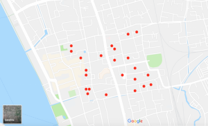
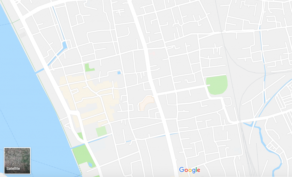
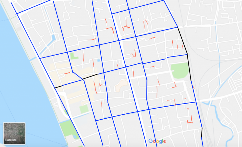
Discontinuous roads: I’m sure most people have faced this, when you are traveling to a new place, you end up at the end of road, you will have to turn around and almost no space to do so. The roads do not connect and often lead to dead end without any marking of a “DEAD END”. In the map of Cochin MG Road area, I marked few dead ends with red dots, there are many more.
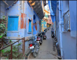
Purchasing property or renting: No public road to the property, street not wide enough, noise because of nearby factory operations. I think most city dwellers might have faced these issues when buying a property or renting a place. Why can’t it be that all property have properly connected road and we know if its residential or commercial?
Pickup/Delivery: Currently, the addresses to residential or commercial places are not exact. It is based on approximate location details and associated with a landmark. Delivery addresses usually say “Near To:”, and you will need to call the person to find out the exact house after getting there. This problem will increase exponentially in the coming years with online purchasing and ride hauling services.
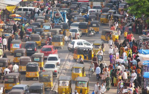
Traffic: Lot of time people are stuck in traffic for a long time because that road is the only way to destination. Not just during office hours, but most of the time. Why are there no alternative roads?
The root cause of all these issues is poor urban planning. Most development happen on the go, they are not planned. Hence, cities do not plan for markings, width of road, pavement and interconnection with the whole city.
Ideas:
Grid plan seems to be the most efficient way to plan a city. Most cities around the world use the grid structure layout. The infrastructure cost is higher to implement grid patterns, it depends largely on four variables: street width, street length, block width and pavement width. Two inherent characteristics of the grid plan, frequent intersections and orthogonal geometry, assist pedestrian movement. The geometry helps with orientation and way-finding and its frequent intersections with the choice and directness of route to desired destinations.
It is not possible to convert a whole city to a new structure in a time sensitive and economical way. However, most cities follow a somewhat grid like structure and with knowledgable & skilled urban planners, it is possible to make huge improvement.
Take the following example from MG Road area of Cochin. The blue lines are existing streets. As you can see it follows a somewhat grid structure, which can be completed into a grid if we build the missing streets which are the black lines. These grid lines would need to be converted to main streets, rather than small streets. The creation of grid and blocks by the blue lines help city planners and administration better regulate and plan for each block. As also mentioned in the advantage of grid structure, this layout would help pedestrians and drivers alike. The red lines are to fix dead ends and create interconnectivity, so traffic can move through different paths to reach the same destination.
Once a grid-like structure is established, it will be easier to monitor traffic and implement lane traffic rules. It will help in making future traffic decisions easier, for example deciding which streets need to be widened or made one-way only. Utilize the remaining portion of the road for bicycle traffic and proper sidewalks for pedestrians. Our vast network of Agricultural Colleges can help deciding and planting trees to make the area more pleasant and beautiful.
It is easier to name and number the streets in a grid system, and hence addresses to property locations can be improved. Address will not have to mention the nearby landmark. A unique house number and street name allows your ride/package to arrive correctly to your doorsteps.
Land Use Classification: We already have land use classification in most places, dividing areas for commercial, industrial, residential and other types. However, they are not strictly enforced. If we enforce and separate the areas, it might actually lead to higher auto traffic on the roads. Because each family will have to drive from home to school or work or hospital or shopping, each in a separate zone. The current need of hour is to make cities more walkable. More focus should be on transit system, mixed use neighborhoods and walkability within the neighborhood.
The current land use in Cochin is better compared to some developed countries, because it allows creation of neighborhoods with mixed land use. This promotes healthy lifestyle like walking or bicycling to work/school/shopping/hospital. Each neighborhood should also include public spaces like parks. There has to be strict implementation of pollution control and commercial/industrial areas have to be constantly monitored for pollution levels because of proximity to residences.
Low Cost Housing: I strongly feel that the market adjusts itself to demand and supply. So my initial thought was low cost housing for low income people should be at cheaper locations, mostly at outskirts of city, so that it doesn’t create market discrepancy. However, as I read and understand more about this, I see that it will lead to income based segregation. This is not healthy for equality and economic growth. Instead, I think there should be no low income housing at all. Local government should help (with grants or loan) purchase a house for low income citizen at market rate within any neighborhoods.
Street Infrastructure: Connectivity of streets also help us in redesigning our pipelines and electric lines. Since the streets are connected, we can build wastewater pipelines underneath the roads connected with each other and leading to waster water facility. We can also setup efficient water supply to every location. Currently, there are places in Cochin which have to be served by water tankers because building a pipeline is not feasible to that location. This would change with connected streets. We can also move electric lines under the street to create safe environment above the street.
Hurdles:
I understand that it is difficult to make any big scale changes because it requires agreement from lot of stakeholders and an even bigger financial capacity. There will be lot of opposition to any such large scale changes. However, if benefits are presented in an easy understandable format, this hurdle can be overcome. Also, inter connectivity of streets as a first step should be a smaller undertaking, effecting few people and bringing benefits for all. People will support the initiative if it improves their daily life.
Property Sales, Taxes, Black Money (Updated Apr 2019)
The government of India demonetized the largest bank notes by end of 2016. Though many people hailed the step as a way to eradicate black money, I was sure it wasn’t. There are different sources of black money, and the government seems to be trying to stop the means rather than the source. One of the biggest source of black money is real estate.
Every property in India has a circle rate, a value assigned by the state government for that piece of property. The actual value of the property is the market value, which is much higher. When people buy property, they show the circle rate as the value and pay stamp duty on that price for purchase. For example, if a property is sold for 1 crore rupees, in the contract it is shown at circle rate, maybe around 30 lac rupees. The remaining 70 lac rupees received by the seller becomes black money because it is not accounted for. The buyer pays 5-10% stamp duty on 30 lacs. So the buyer saves on stamp duty and seller saves on income tax on sale of fixed asset. Thereby creating black money.
So instead of hailing the government for banning certain bank notes, if each citizen decides to show the actual market value of the property on the contract, it will eradicate a huge percentage of black money from the system. Is everyone ready to do that?
My solution is that the states should get rid of this arbitary circle rate. Instead people should be allowed to buy/sell at any value they like. Each property sale value should go into a database, and an average market rate should be generated for each locality. If a new sale value is very different from the average rate, then a red flag shows up and the authority can investigate if it was a legitimate transaction. Also, to incentivize the buyer to report correct value of the property, state governments should reduce the stamp duty to 1-2%. Instead, government can increase the annual property tax to make up for their revenue loss.
Railway (Updated Oct 2019)
Railway is an important transportation backbone of India. However, in Kerala, railway tracks pass through heavily populated areas. This causes more infrastructure work for the state because the number of railway crossings increases. And as the population and number of vehicles increase, the railway crossings are converted to flyovers, which require even more space.
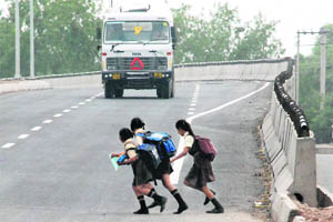
Instead, if we convert the entire railway track from north kerala to south kerala to be an elevated railway track, we can reuse all the land space in an efficient way. There will no longer be a need for railway flyovers and no waiting at crossings. Also, people will no longer be casually crossing the tracks in a busy area and hence no accident or death on the track.
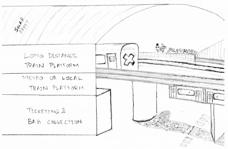
This is a huge infrastructure undertaking and can only be done in sections. The main problem with this concept is railway stations. We cannot build railway stations on the ground, otherwise trains will have to go up and down all the time. However, look at how metro works. Kochi metro has platform on the top floor. Let’s convert all the railway station to a similar layout.
Another problem is goods train and loading/unloading of goods from them. So we have to build a mechanism for goods to be loaded and unloaded from the trains at higher platform. This requires big elevators which can bring one entire train bogie up or down. Humans have built huge engineering marvels, an elevator is small task!
Easy of transportation can be improved tremendously with add-ons. We can build local/metro lines under the elevated bridges and a platform on level 1 of the stations. Providing passengers an easy way to switch between long distance train and short local trains.
Once the entire railway track is elevated, the land underneath can be reused for various purposes – like vehicle parking for station or just planting trees. It will also reconnect people on both sides of the track with easy access to the other side.